TN LANDSCAN

Tough Jobs | Easy Data Flow

MIDDLE TN
DATA CAPTURE

"Stop Building in the Dark." From golf courses to bridge decks, we turn chaotic job sites into precise digital twins.

Construction Services

DON'T GUESS.
MEASURE.

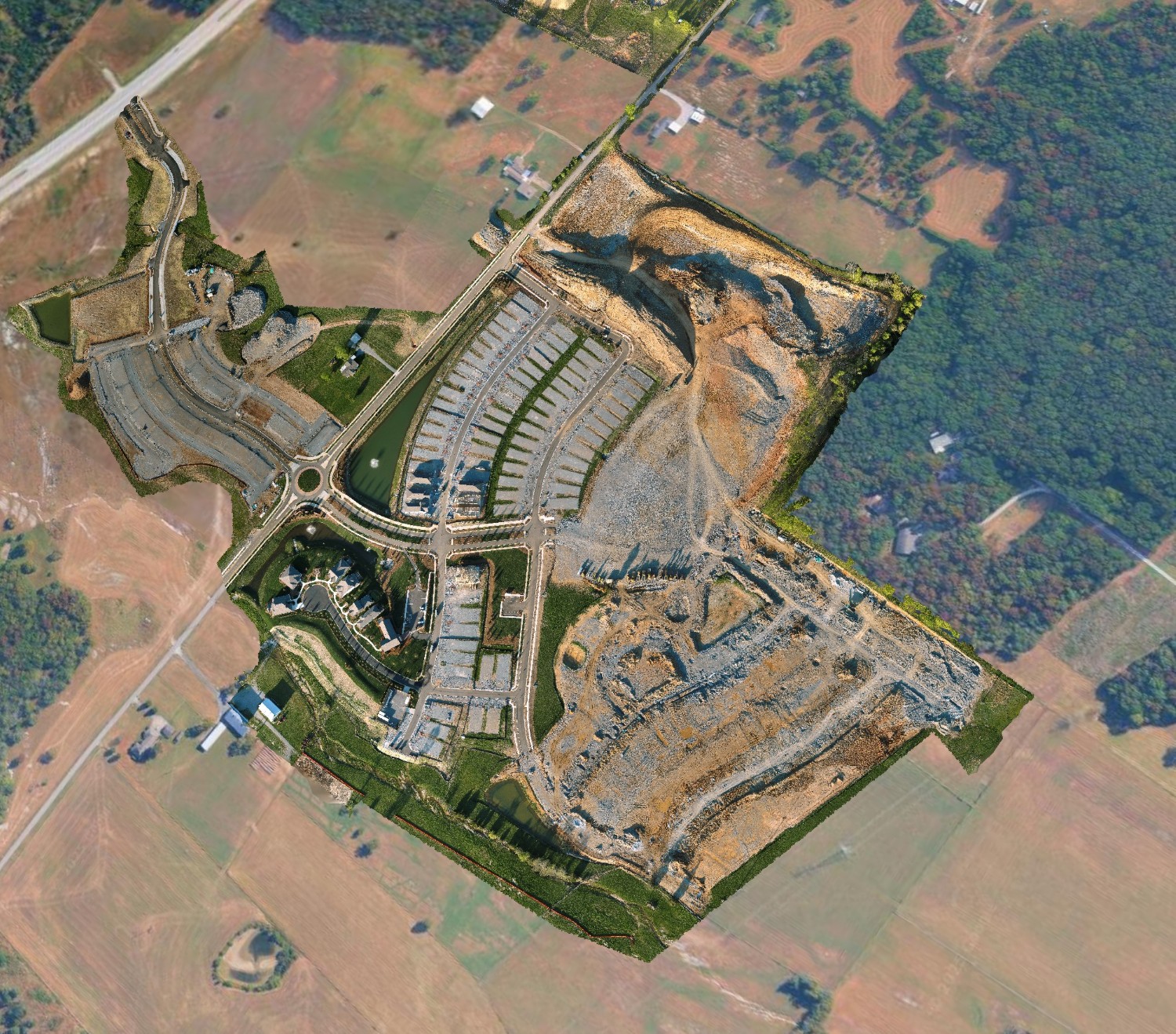
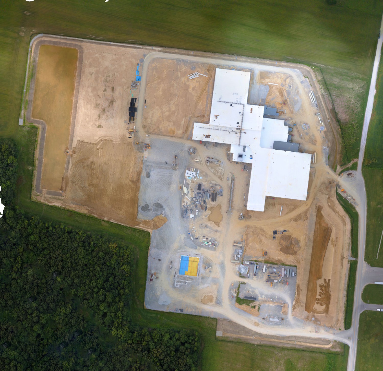
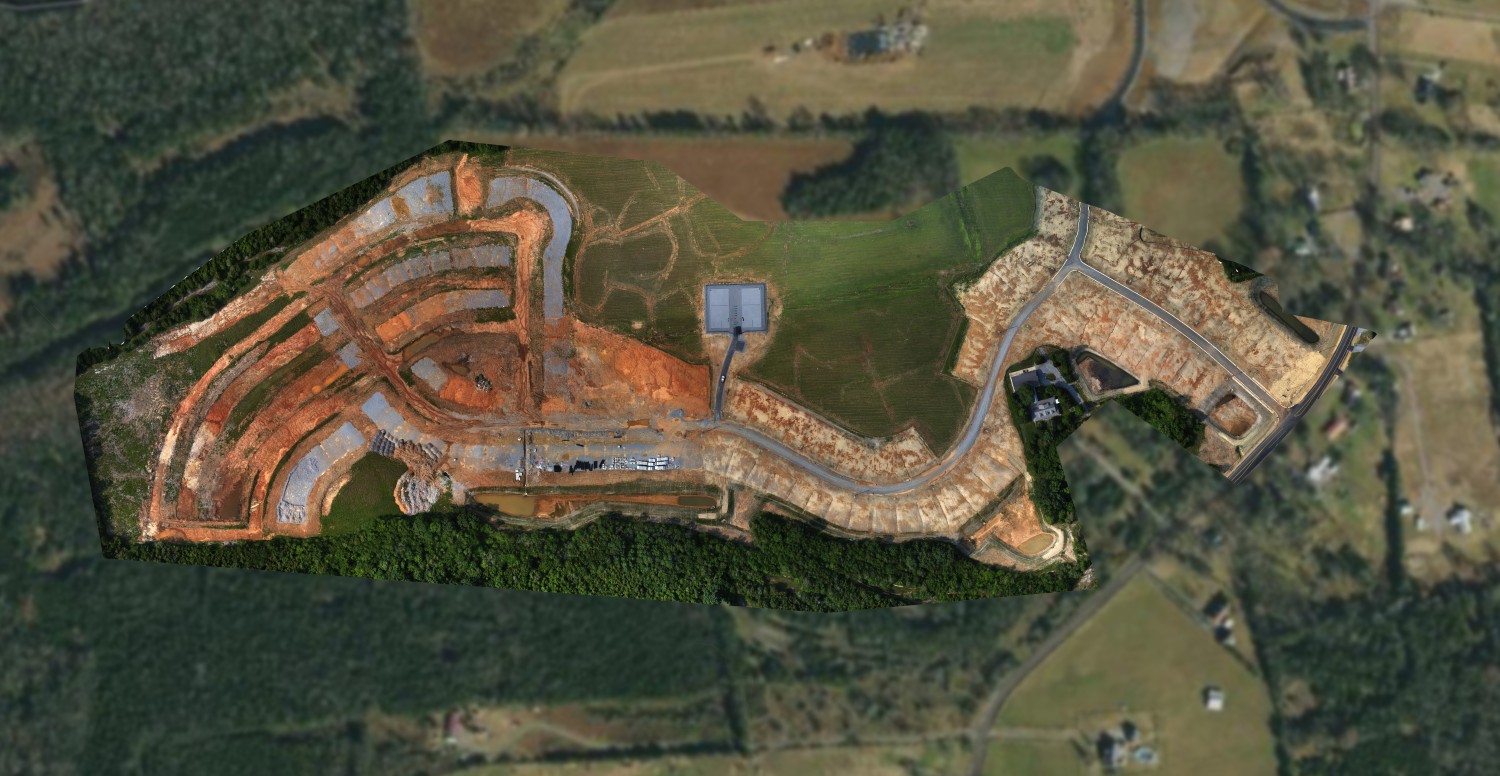
Replace disjointed photos with a complete visual record. Our "digital twin" approach ensures every stakeholder sees the same reality, reducing disputes and rework costs.

πŸ—ΊοΈ2D Site Maps

High-res orthomosaics for logistics, staging, and safety planning.
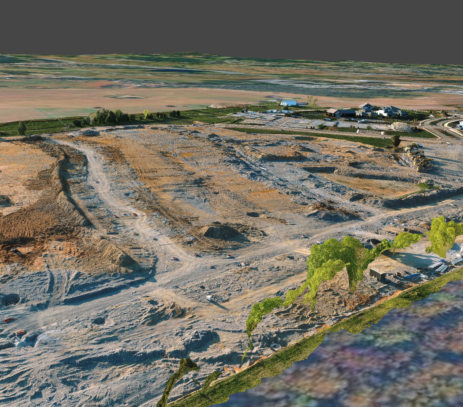
πŸ“¦Volumetrics

Accurate Cut/Fill calculations and stockpile measurements.

βœ“Progress Tracking

Visual timelines to verify work completed for billing.

🎲3D Models

Walk the site remotely. Measure distance, height, and area.

Construction Site

Recreation & Property

TURF, TRAPS & PORTFOLIOS

"Work Smart NOT Hard." Modernize maintenance with aerial intelligence.

πŸ’§

Irrigation

Detect leaks and drainage issues before they kill the green.

πŸ“Š

Capital Planning

Precise measurements of roofs and lots for accurate vendor bidding.

🌍

Portfolio View

Inspect assets across multiple properties without leaving your desk.

πŸ†

Marketing

Showcase properties with 3D tours to attract high-quality members.

Radnor Lake

Natural Resources

STATE PARKS & PUBLIC LANDS

Managing Tennessee's vast natural beauty requires scale. We help rangers and land managers monitor thousands of acres without leaving the trailhead.

🌲 Vegetation Health

Analyze forest health and identify invasive species like Kudzu.

πŸ₯Ύ Trail Mapping

Accurate GPS maps of hiking trails for safety and maintenance.

Critical Infrastructure

INFRASTRUCTURE AT RISK

TDOT data reveals a growing gap. With 52 "Poor" rated bridges in key counties alone, traditional inspection methods are too slow.

$14,600 Cost of 1 Lane Closure
25% Pavement at Risk
Bridge Inspection

Operational Strategy

The Right Club
For The Lie.

We don't justify a massive invoice by deploying an $8,000 enterprise drone for a simple 10-panorama land map.

"That's like hunting a hummingbird with a shotgun."

We select our crew and equipment based on the lie of the ball for each and every project. Whether it's high-fidelity photogrammetry or a quick visual scout, we scale the solution to your budget.

HEAVY LIFT & INSPECTION

Tier 1

For complex surveys, bridges, and thermal analysis.

πŸ… 550+ Documented Flight Hours

AGILE MAPPING & SCOUTING

Tier 2

For pre-planning, property path building, and visual updates.

✈️ Sub-250g Micro-Drones

Beyond Mapping

Creative Aerials

Creative Aerial

ABSTRACT PERSPECTIVES